
In this blog post, Dr. Georgios Arseniou writes about his TLS research and its applications for urban and community forestry. In a second blog post, he writes about his fractal dimension of trees research and its applications for our field.
Using terrestrial laser scanning (TLS) technology is a hot topic in urban forestry now due to the current dearth of urban forest inventories and because tree biomass relates to carbon stocks (i.e., approximately 50% of tree biomass is carbon that has been sequestered from the atmosphere).
In the past we could only estimate urban forest biomass and carbon stocks by harvesting trees to build allometric equations which explains the limited amount of data since tree harvesting in cities is not desirable. However, with the use of laser scanning technologies we can now indirectly estimate tree biomass and carbon stocks without having to cut trees down. With this technology we can better understand the role of urban forests in atmospheric carbon sequestration and climate change mitigation in cities.
What are some examples of how this technology can be used? Cities can participate in forest carbon markets and apply for urban forest carbon credits, which requires that cities accurately quantify their urban forest carbon stocks. City Forest Credits is a non-profit carbon registry that facilitates the sale of urban forest carbon credits specifically designed for cities. City Forest Credits connects funders of urban tree planting projects to organizations willing to dedicate resources to restoring urban forests. TLS technology can be a useful tool in this field because it provides new opportunities for developing accurate and efficient urban forest carbon stock inventories in a non-destructive manner across different spatiotemporal scales.
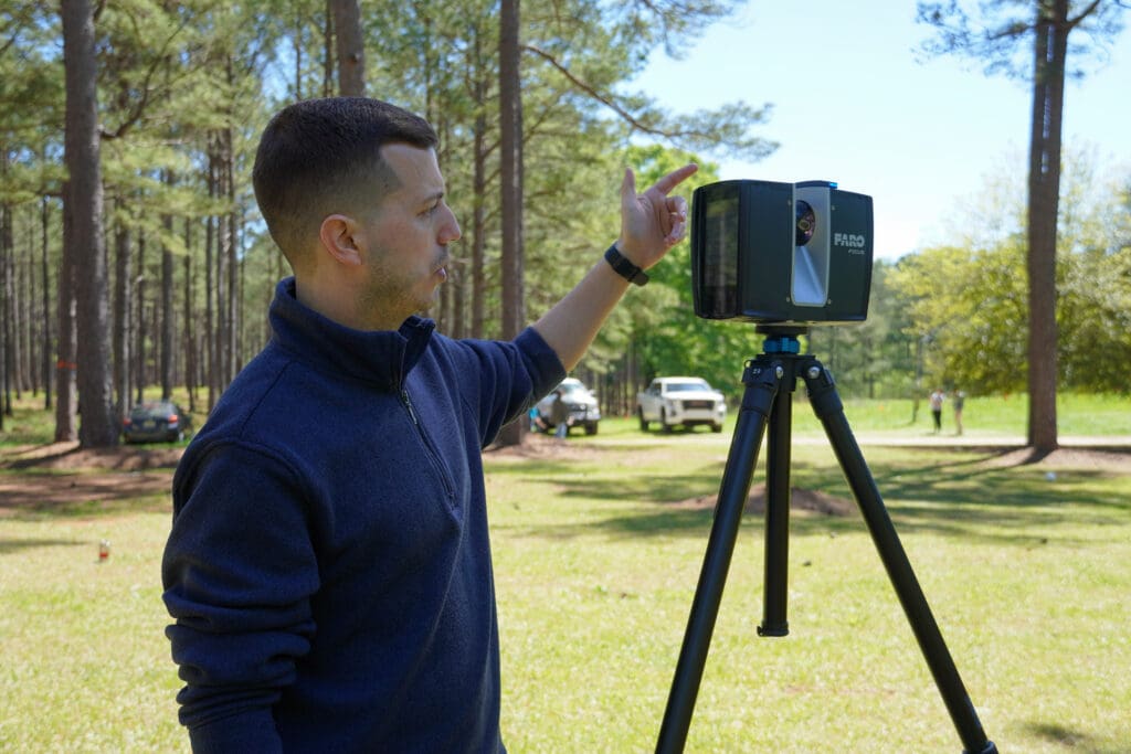
Let’s take a closer look at TLS technology and how it can be used for estimating the aboveground biomass and carbon stocks of urban trees. TLS is an active remote sensing technique where the sensor emits laser pulses and captures the three-dimensional structure of their surrounding environments by creating three-dimensional “point clouds” based on the returned energy that is analyzed as a function of either time (time-of-flight systems) or shift in the phase of the light wave of the emitted laser beam (phase-shift technology), and by using precise angular measurements through optical beam deflection mechanisms.
Modeling the three-dimensional structure of trees based on TLS data can be achieved by generating models that fit geometric primitives to three-dimensional point-clouds in a way that preserves branch and stem topology and provides information about the size, location, hierarchy, and orientation of branching networks. These models provide direct estimates of total aboveground volume of trees based on the number and dimension of fitted cylinders, which can be converted to aboveground biomass when multiplied by estimates of tree basic density. If increment borer samples are collected from a tree and we measure their dry biomass and their carbon content, then we can combine them with the TLS-based tree biomass to estimate total aboveground tree carbon stocks or we can assume that 50% of the TLS-based aboveground wood tree biomass is carbon content.
In a recent study that we published, my colleagues and I found that TLS data provide accurate estimates of the total aboveground biomass of urban trees when compared to reference biomass values measured on urban trees that we harvested after scanning. In another study, we used TLS technology to quantify the allocation of the total aboveground woody surface area (i.e., surface area outside of bark tissues) in branches versus the main stem of urban trees which has important implications for modeling urban tree growth because woody surface area of trees relates to their growth respiration rates. It becomes clear that TLS technology provides novel opportunities to study the structure and function of urban trees in ways that were never possible before without harvesting trees or it was simply too challenging (e.g., total aboveground woody surface area quantification).


TLS technology though is not only a great research tool, but it can also be employed for extension purposes. In my extension program in urban forestry, I work closely with underserved municipalities and cities in Alabama that usually have limited resources to develop accurate urban forest inventories that can be used to create sustainable urban forest management plans. Therefore, I use TLS technology to laser scan large numbers of urban trees of different species to develop accurate and efficient urban forest inventories across municipalities in Alabama.
My long-term goal is to help municipalities to build capacity in urban forestry that can enhance people’s livelihood and well-being in Alabama under a changing climate that adversely impacts disadvantaged communities. In all workshops that I organize across the state of Alabama people get excited about the potential of TLS technology to be used for the benefit of their communities. Especially young students in my youth educational events are always curious and want to learn more about TLS in urban forestry which is important because I want to raise awareness about the significance of urban trees among young people who will be our future leaders in urban forestry.
Dr. Georgios Arseniou is an Assistant Professor & Extension Specialist of Urban Forestry at Auburn University & the Alabama Cooperative Extension System in Auburn, Alabama. He has a PhD in Forestry (2021) from Michigan State University, where his research used novel terrestrial laser scanning (TLS) technology to model urban forest growth, urban forest biomass, structural complexity (specifically: fractal dimension), and wood properties of urban trees.

Citations
- Arseniou, G., MacFarlane, D.W., Calders, K. & Baker, M. (2023) Accuracy differences in above-ground woody biomass estimation with terrestrial laser scanning for trees in urban and rural forests in different leaf conditions. Trees: Structure and Function 2023, DOI:10.1007/s00468-022-02382-1.
- Arseniou, G., MacFarlane, D.W. & Seidel, D. (2021) Woody Surface Area Measurements with Terrestrial Laser Scanning Relate to the Anatomical and Structural Complexity of Urban Trees. Remote Sensing 2021, 13, 3153. DOI: 10.3390/rs13163153.